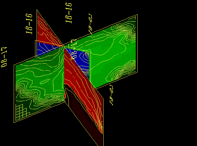
Here you can see the set of the vertical bore-hole seismic tomography sections crossing.
Wide range of different transparent or solid planes and surfaces with different colors and orientations can be combined.
![]()
Different graphs may have different spatial directions. Color may be used for the different value levels distinguishing.
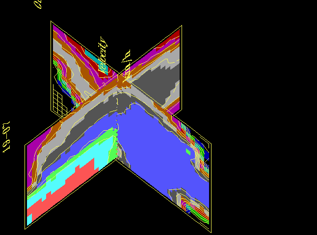
Any combinations of different data gathering systems - horizontal, vertical, inclined or non-planar, or any other are appropriated.
![]()